In a tucked away corner of Aotearoa New Zealand, far from any roads or access from the coast, lies the Pole of Inaccessibility. This point represents pure wilderness, a remote escape from the comforts of civilisation, and an alluring invitation for adventure. With assistance from the Federated Mountain Club (FMC), this point became the focus of our big expedition. The Pole of Inaccessibility (44°16’54”S 168°33’31”E) is positioned in the heart of the Olivine Wilderness Area, midway down a narrow spur east of the Olivine Range. The point was identified by Andrew Douglas-Clifford, aka The Map Kiwi, in his map named ‘Far From Any Road’. We stumbled upon this map one day – most likely searching for distractions during our engineering studies. The idea ballooned from there… How awesome would it be to reach this point and explore the West Coast wilderness around the Olivines, Red Hills Range, and the Cascade Valley? We gathered our small group of explorers; my boyfriend, Sam, and my high school friend Micaela, stocked up on protein-rich snacks from Off-Piste Provisions, and stashed everything we needed into our packs. Following some weather delays, we left Christchurch for the long drive down to Haast at the start of February 2023.
Day 3: 8th February 2023 – Upper Cascade Valley
The rain passes through the valley in a steady drizzle. Blankets of grey cloud intermittently obscure the surrounding mountaintops as a light wind blows through the Cascade Valley. This morning we could see a fresh dusting of snow on the rocky outcrops of the Olivine Range. Droplets of rain knock on the tent fly, while hundreds of mosquitos seek shelter on the inside, swarming to get out. In harmony with the infinite whoosh of the Cascade River, and the occasional tent rustle, these noises form the soundtrack to our bad weather day deep in the Cascade Valley. The rain seems to have no intention of stopping this morning. The thought of donning all of our wet, cold gear for another day of walking in the wet and cold is not enticing. Instead, our gear hangs heavy with rain on the branches beside our tents.
We made a solid effort to tramp this far up the valley over the last two days. The days were long, as we circumnavigated the swollen banks of the seething Cascade River, with some rough West Coast bush-bashing. A lot of rain had fallen in the days before we started walking, and the river was very high and turbid. Where the river permitted, we skirted around its margins, clambering over rocks and trees. We ate our lunch during a brief breakthrough of sunshine, overlooking a small tributary of the river. To our awe, a flock of about 20 kererū careened through the sky above us, landing heavy in the branches of some miro trees across from us. In the evening of the first day, we reached a small hill west of Woodhen Pond, where the river narrowed into a gorge. Our progress through the steep, tangled bush was slow, and the energy of the group was low. After relocating some moss, we transformed a relatively flat spot of bush into a comfortable camp spot for the night.

The following morning, we descended back down to the Cascade River, cooking up some porridge before the mosquitoes could find us. The rain set in around mid-morning, as we followed the blue-grey rage of the Cascade River further up the valley. We soon walked out into open river flats and pushed further in the rain to set up camp under a small stand of trees near our main river crossing.
Day 4: 9th February 2023 – North end of Red Hills
The rain had stopped falling late yesterday morning, so the river has calmed. Its level had dropped about 1 metre over the course of 24 hours. Yesterday, we had identified our river crossing points to get us safely to the other side. Linking up and braving the cool waters, we crossed the river without a hitch, apart from getting our undies wet. So we will be expecting an extra $7 an hour of pay (according to Micaela the DOC Ranger). Although our walk up the valley wasn’t easy, we had now reached our big climb up the spur onto the Red Hills. We spent the morning following the spur through West Coast bush, navigating sections of moss, ferns, bush lawyer, trees, and other shrubs that liked to poke, prod, and scratch at us. After about 1.5 hours of climbing, we emerged out of a tangle of scrub and waist-deep ferns into a large clearing lined with tussock and sub-alpine herb fields. A small stream snaked through the grasses. Beneath an old tree trunk we found a blue tarp, a LeSnack packet, soup sachet, and salami wrapper dating back to 2003. It’s incredible to think that you can still find the remnants of previous visitors in a place so far from civilization, and that people think it’s ok to trash such a pristine environment! This little oasis was beautiful to explore, listening to the squelch of our footsteps and the croaking of hidden frogs. We passed through several more of these clearings as we bush-bashed through the connecting thickets of vegetation. This involved a lot of wriggling to get free from the greedy grasps of bushes, weaving over fallen logs, and crawling on our hands and knees under small passages in the scrub.

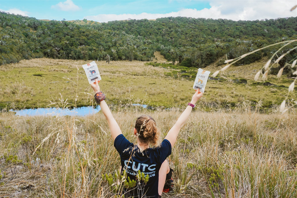
By lunchtime, we had climbed about 950 metres. The view of the surrounding landscape was well worth the effort. We ate lunch in the tussock at the top of the Red Hills range. Today’s feast was dehydrated hummus wraps with Off-Piste Provisions plant-based crackling – a winning combination of salt and deliciousness! From our perch, we could see out to the Tasman Ocean. It felt incredible up on the tops. Beyond the golden carpet of tussock, dotted with small tarns, the Olivine Range dominated the landscape. Each peak and valley along the range was different from the next. Iron-red mountain rocks resembling Martian terrain stand above verdant green river valleys. Polished ultramafic peaks flanked with thick West Coast bush lay next to the towering stone pillars of Falls Creek, a succession of vertical rock slabs sweeping above a hanging valley. Behind the Olivines, snow-crusted peaks frequently emerge from the clouds, hinting at bigger mountains and ice fields just another range away.
We set up camp next to one of the northern tarns below pt. 1031, testing our spot for hidden lumps in the grass. Sam and I went for a further explore south along the Red Hills Range to try get a better view of Red Mountain. Unfortunately, its red peak was obscured in clouds. We ran along the slanting ridgeline of the range towards a large sparkling tarn in the basin below, spotting two deer on the way. Back at camp, we went for a dip in the tarn and ate our dinner in the sunshine. The sun wasn’t setting until 9 pm, so we had a delicious evening relaxing and enjoying the light.
By this point in the trip, we had made the decision to discontinue our full route to the Pole of Inaccessibility. The conditions earlier in the week had slowed us down, and I wasn’t confident that our whole group would be comfortable or fast enough to tackle the terrain to come. The Pole of Inaccessibility would remain inaccessible to us until next time. We were very happy to make our major river crossing and reach the Red Hills Range today, however, tomorrow we were going to turn around and make our way home back out the Cascade Valley.

Day 6: 11th February 2023 – Back in Cascade Valley
Today has been beautiful. We had several kea join us at our camp last night, and they were very excited to wake us early this morning with their playful screeching. As if a spell had been lifted, the river’s wild ferocity had transformed into a peaceful, easy flow. The water is cold and clear; the riverbed a tapestry of grey, brown, and blue rocks shimmering under the surface. The sky is cloudless and the sun is intent on heating up the valley.
The river has dropped between 1.5-2 metres since we last walked through about 4 days ago. This made our journey back down the valley straightforward, as we hopped along the rocky river banks. Our vibe was restored after lunch and a refreshing swim in the river. We were on our way to the land of kererū, where we recalled there being some decent campsites. As we walked, the valley stretched on and on. Everything looked different without the torrents of rain and river water. Eventually, the heavy whoosh from a pair of kererū through some beech trees marked our arrival at our final camp for the trip. We were hot and tired, and in desperate need of another swim. Reflecting on the journey over dinner, we all agreed that we will soon miss the simplicity and beauty of our week lived in such a special place; our only purpose each day being to walk, eat, chat, sleep, and enjoy the environment around us.
The decision to discontinue our route to the Pole of Inaccessibility was difficult. We had come so close and were enjoying our adventure deeper into the wilderness. It was a decision that I ruminated on for most of the trip, wishing that we could’ve been tramping on the Olivines and anxious about not meeting my expectations of the trip. But, at the end of the day, our only expectations for the trip were to have a fun adventure and to return safely. From this perspective, our expedition was an absolute success! We had an incredible time exploring the Cascade Valley and Red Hills, witnessing flocks of kererū and epic mountain scenery. Plus, we all returned home safely, adding valuable tramping experiences regarding river safety, weather conditions, trip planning, and managing the needs and abilities of the group. We were also stoked to have Off Piste fuel our mission – their plant-based jerky always provided a well-need boost. It was one epic, wild adventure!
I can still hear the beckoning call of the Olivine Mountains – I know it won’t be too long before we attempt the journey again.
by Nicole Cameron


